


COLORADO TOPO MAP SALESThe following basics pertain to a stack of topographical maps that were purchased from a failing sporting goods store and we just couldn't let them get thrown out. • These maps are, with few exceptions, used. This means they were purchased and sat in the sporting goods store waiting to be sold. They have very slight wear from handling, except where noted. Dirty maps can be cleaned with a soft gum eraser.
• 1986 and newer maps have barcode stickers on them, despite the revision date.
• Revision dates are taken from each individual map. “(newer issue)” indicates new maps.
• 2001 and newer maps have USFS trail numbers, some property boundaries, and show the latest changes in trails and topography.
• Maps will be folded in half once, and then in thirds, unless a special request is made. Special requests will require more expensive shipping and handling fees.
• Maps will be shipped in legal size envelopes via USPS unless otherwise requested.
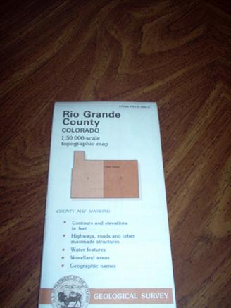
• Regional Maps are 1:250,000 scale, and County Maps are 1:50,000 scale.
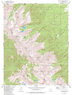
• 7.5 minute quads are all in the state of Colorado except where noted.
• 7.5 minute quads are the best known maps and give accurate coverage for land navigation, contour intervals, and topographical features. 15 minute quads give coverage of larger areas, and still be used to navigate on foot accurately.
•
Due to formatting issues, we are unable to list the inventory at this time. A complete inventory is available by hitting the Contact Us button and filling out the request form. |